Loading...

Hike Kilimanjaro via the Lemosho Route

About Lemosho Route

The Lemosho Route is renowned as the most scenic path on Kilimanjaro, offering breathtaking panoramic views from multiple angles of the mountain. It strikes an excellent balance between fewer crowds, stunning landscapes, and a high summit success rate.

This route is highly recommended for those seeking a more gradual ascent with an optimal acclimatization profile. On average, trekkers can expect to hike for 6 to 8 hours daily, covering distances of approximately 8 to 15 kilometers. The maximum vertical gain in a single day is around 1,200 meters, with an average daily ascent of 500 to 600 meters.

What to Expect on Lemosho route

The Lemosho Route is one of the most scenic and well-regarded routes to summit Mount Kilimanjaro. Here's what you can expect if you're planning to hike this route:

Lemosho Route Detailed Itinerary

Trekking Kilimanjaro via the Lemosho Route is available as a 7-day or 8-day journey. The 7-day option merges days five and six, skipping an overnight stay at Karanga Camp and heading directly from Barranco Camp to Barafu Camp.

Image
Day 1 – Londorossi Gate to Mti Mkubwa Camp

At 8:00 AM, we will depart from the hotel and make our way to Londorosi Gate on the western side of Mount Kilimanjaro. From there, we will begin our hike at the Lemosho trailhead.

Please note that during rainy or muddy conditions, vehicles may be unable to reach the actual trailhead, requiring additional hiking. After enjoying a picnic lunch, we will trek for approximately 4 hours through the forests of the Lemosho glades to reach Big Tree forest Camp.

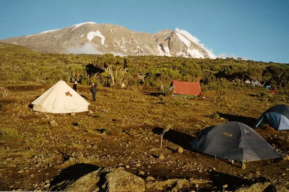
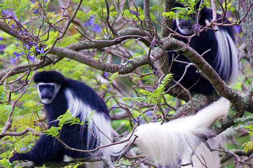
In the forest, vibrant moss and exotic flowers create a visual spectacle, while bird calls provide a natural melody. You may encounter Black and White Colobus monkeys and spot signs of elephants roaming the area. We will overnight at Forest Camp.

Elevation: 2,100m → 2,850m (6,890ft → 9,350ft)

Distance: 6 km

Hiking Time: ~3–4 hours

Terrain: Rainforest

Image
Day 2 – Mti Mkubwa to Shira 1 Camp

As we exit the Montane Forest and enter the Hagenia zone, the landscape opens up, revealing our first glimpse of Kibo Peak. This hike is excellent for acclimatization, as we ascend and descend multiple ridges en route to our highest elevation of the day at 11,500’ before descending to camp. Overnight stay at Shira 1 Camp

Elevation: 2,850m → 3,500m (9,350ft → 11,500ft)

Distance: 8 km

Hiking Time: ~5–6 hours

Terrain: Moorland

Image
Day 3 – Shira 1 to Shira 2 Camp

We will cross the Heath zone of the Shira Plateau and start ascending the western slope of the Kibo Massif. Along the journey, we will pause for a picnic lunch at Scott Fischer Memorial Camp, named after the renowned Mount Everest guide.

Our gradual ascent through the moorland of the Shira Plateau will aid in acclimatization while offering stunning panoramic views. Today's destination is Shira 2 Camp. In the afternoon, you will take an acclimatization walk before returning to camp for dinner and an overnight stay.

Elevation: 3,500m → 3,900m (11,500ft → 12,800ft)

Distance: 7 km

Hiking Time: ~3–4 hours

Terrain: Alpine desert

Image
Day 4 – Shira 2 to Lava Tower, then Barranco Camp

We leave the heath zone and enter the alpine zone as we hike 4-6 hours past Lava Camp (up to about 14,300’) with its volcanic landscape,Our highest point of the day offers a perfect spot to enjoy lunch. In the afternoon, we make a steep descent to our campsite for the night, nestled at the base of the Great Barranco Valley (3,960 m). The camp is sheltered by towering cliffs while providing expansive views of the plains below.

Elevation: 3,900m → 4,630m → 3,960m (12,800ft → 15,190ft → 13,000ft)

Distance: 10 km

Hiking Time: ~6–7 hours

Terrain: Rocky alpine desert

Image
Day 5 – Barranco Camp to Karanga Camp

Our day begins with a descent into the Great Barranco, a vast ravine. We then make a steep ascent up the Great Barranco Wall, which separates us from the southeastern slopes of Kibo. This climb over rock is not technical but can be long and demanding. As we pass beneath the Heim and Kersten glaciers, we continue toward the Karanga Valley. From there, a steep climb leads us to our campsite at Karanga Camp (3,963m). For those feeling strong, an optional mid-afternoon acclimatization trek will take us up to approximately 4,200m before we return to camp for the night.

Elevation: 3,960m → 4,035m (13,000ft → 13,250ft)

Distance: 5 km

Hiking Time: ~4–5 hours

Terrain: Scrambling (Great Barranco Wall)

Image
Day 6 – Karanga to Barafu Camp

After a restful night and a hearty breakfast, we begin our trek to Barafu Camp at 4,640m. The route takes us across barren scree slopes, with no vegetation in sight. This steep and challenging climb is made even more demanding by the increasing altitude. Upon reaching camp, we have a meal and spend the afternoon resting in preparation for the strenuous night and day ahead. Staying hydrated and keeping warm is essential. We have an early dinner before attempting to get some sleep, as we will be waking between 11:00 PM and midnight to begin our ascent to the summit.

Elevation: 4,035m → 4,640m (13,250ft → 15,220ft)

Distance: 4 km

Hiking Time: ~4–5 hours

Terrain: Alpine desert

Image
Day 7 – Summit Night – Barafu to Uhuru Peak, then Mweka Camp

You'll wake at 11:30 PM for hot tea and biscuits before beginning the steep ascent of Kibo in the darkness. After a short break at Hans Meyer Cave, the climb continues to Gilman’s Point (5,681m), taking approximately 5-6 hours. As dawn breaks, enjoy breathtaking views of Mawenzi Peak before trekking for another two hours to reach Uhuru Peak. After capturing a few quick photos at the summit, you'll descend to Stella Point (5,739m) and then back to Barafu Camp (4,680m). Following a brief rest, the journey continues down to Millennium Camp (3,950m) for your final night on the mountain. This challenging trek takes 14-16 hours, so maintaining a steady pace, staying hydrated, and conserving energy are essential.

Elevation: 4,640m → 5,895m → 3,100m (15,220ft → 19,341ft → 10,170ft)

Distance: 17 km

Hiking Time: ~12–15 hours

Terrain: Ice and rocky terraint

Image
Day 8 – Mweka Camp to Mweka Gate

A gentle descent leads us through the lush rainforest to Mweka Gate, where we complete park formalities and receive our well-earned certificates—proud souvenirs of our achievement! From there, our vehicles will meet us for the return journey to the hotel in Moshi. Upon arrival, you can enjoy a refreshing shower before celebrating with well-deserved cold drinks. Overnight stay at your arranged hotel.

Elevation: 3,100m → 1,640m (10,170ft → 5,380ft)

Distance: 10 km

Hiking Time: ~3–4 hours

Terrain: Rainforest

Price Packages

Awesome Package

Lemosho Route Prices

We prioritize safety and quality above all else, which is why our prices are not the lowest. However, they remain fair and reasonable compared to some higher-priced companies. We take great pride in offering excellent value for money to every client. The per-person rates below vary depending on the number of people booking the trek together.

Image
Image
Historical Trip
View All Place
Image
Family Tour
View All Place
50% Off
Image
Beach Tour
View All Place